


JOUAV demonstrates real-time mapping technology that helps emergency managers assess hazards and plan safer rescue operations
When landslides strike, emergency crews face an immediate challenge. They need to know where it is safe to send responders. Following a landslide in Pengshui County, Chongqing, on July 17, JOUAV demonstrated how real-time drone mapping can help emergency managers answer that question before crews move into hazardous areas.
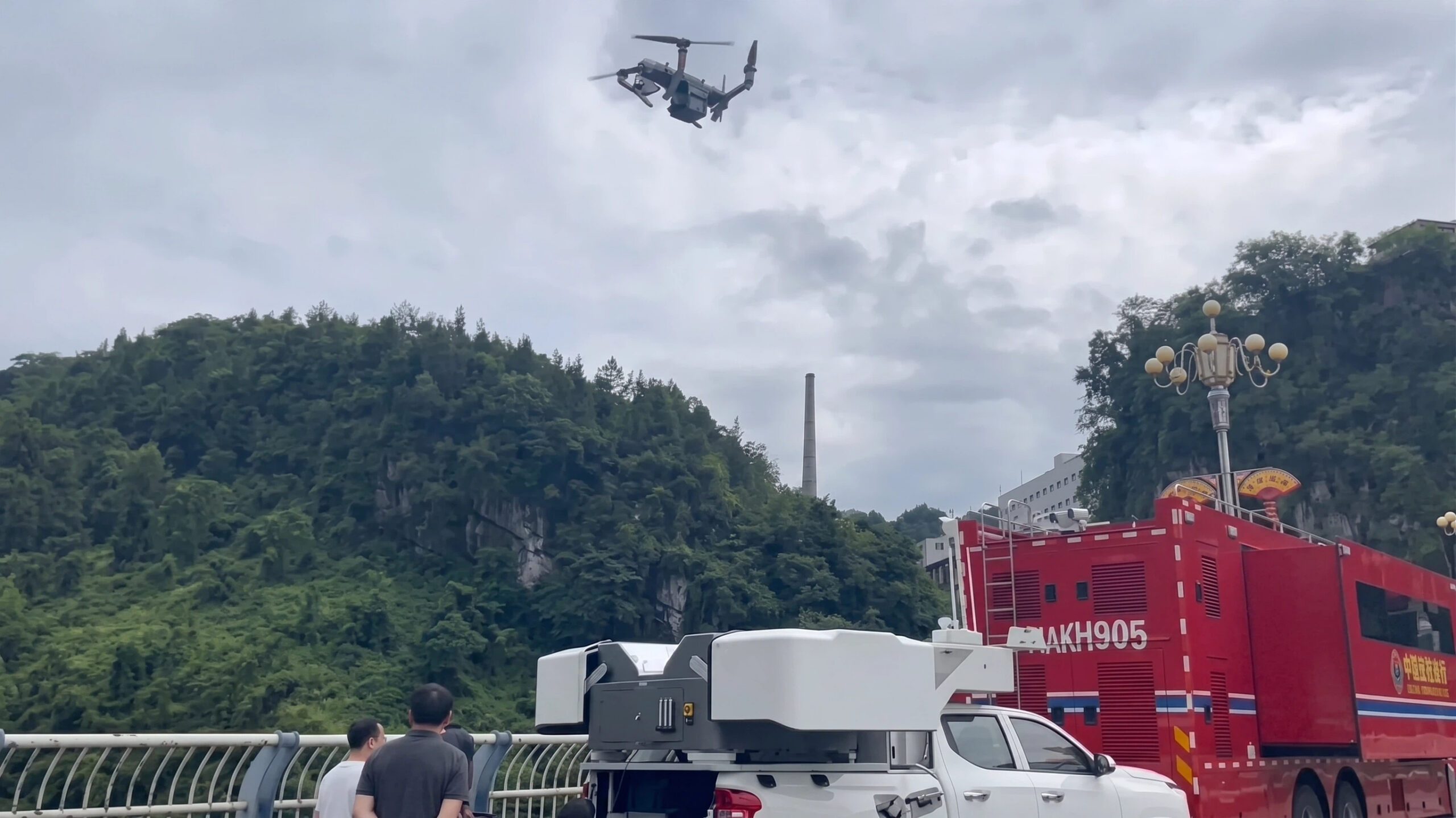
Using its JOS-P200 vehicle-mounted drone hangar, the company launched an autonomous aerial reconnaissance mission within minutes of arriving on site. In about one hour, responders received high-resolution aerial imagery and a detailed 3D model of the affected area. According to JOUAV, the data gave the command center an updated view of terrain conditions, landslide boundaries, and potential secondary hazards before committing personnel and equipment to the scene.
The deployment illustrates a growing role for drones in disaster response. When damaged roads, unstable ground, or dangerous conditions limit access, aerial mapping can provide critical information without placing responders at additional risk.
Helping Responders Decide Where to Go
At the center of the deployment was JOUAV’s JOS-P200 Real-Time 3D Mapping System. The platform combines a PH-10H multirotor UAV, remote sensing payloads, broadband communications, edge computing, and real-time modeling software.
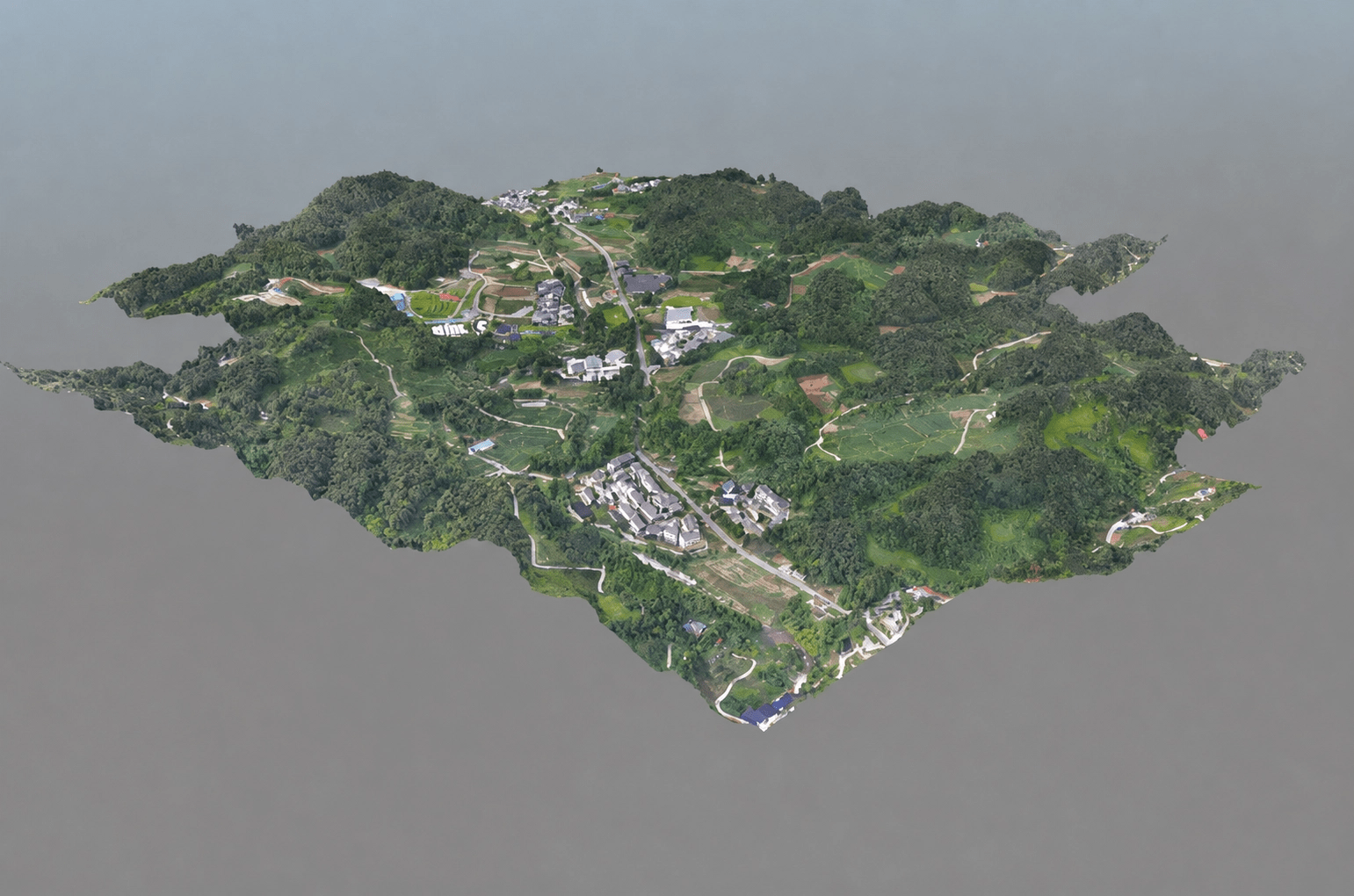
Unlike traditional mapping workflows, which often require processing after the aircraft lands, the system collects, transmits, processes, and models data at the same time. Orthomosaic maps, digital surface models, and textured 3D models become available while the drone remains in flight.
Unlike standard aerial video, a 3D model allows emergency managers to measure terrain, identify blocked routes, estimate the extent of the landslide, and better understand elevation changes that could affect rescue operations. That information can help incident commanders decide where to send crews and equipment first.
JOUAV says the system delivers spatial resolution of up to 10 centimeters and can model a one-square-kilometer disaster area in less than five minutes. The company says this reduces the time needed to produce the first operational map for emergency decision-making.
Beyond Live Video
Live video can show responders what a disaster scene looks like. A live 3D model provides additional context by allowing teams to measure distances, identify hazards, and mark locations while the aircraft continues collecting data.
According to JOUAV, the platform combines aerial imagery, live video, broadband communications, edge computing, and AI-assisted analysis into a single workflow. Emergency teams can identify roads, buildings, vehicles, forests, waterways, and other key features directly within the live 3D environment. They can also perform measurements, conduct spatial analysis, and add annotations without waiting for post-flight processing.
The company also says the platform can integrate field sensor data in real time, giving command personnel a more complete operational picture throughout the response.
Expanding Coverage for Larger Disasters
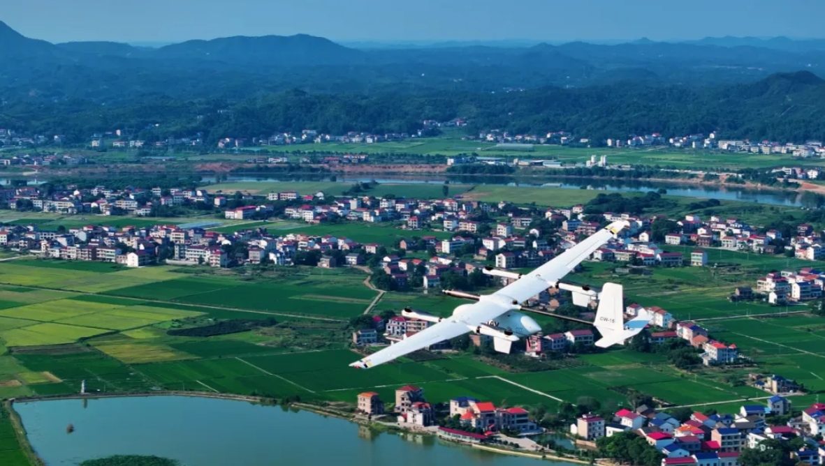
For larger incidents, JOUAV offers a similar real-time mapping solution built around its CW-15 VTOL UAV. The company says the aircraft supports long-range BVLOS operations across complex terrain while continuously transmitting mapping data to a mobile processing terminal for live scene reconstruction.
In a recent deployment, JOUAV reports that a CW-15 equipped with a five-camera oblique mapping payload generated a detailed 3D model covering 2.18 square kilometers about five minutes after data acquisition.
Fast disaster response depends on good information as much as it depends on personnel and equipment. As drone mapping systems continue to reduce the time needed to build accurate 3D models, emergency managers can begin planning rescue operations sooner and with a better understanding of the risks facing crews on the ground. While this deployment took place in China, the need for rapid situational awareness is shared by emergency response agencies around the world.
Read more:

Miriam McNabb is the Editor-in-Chief of DRONELIFE and CEO of JobForDrones, a professional drone services marketplace, and a fascinated observer of the emerging drone industry and the regulatory environment for drones. Miriam has penned over 3,000 articles focused on the commercial drone space and is an international speaker and recognized figure in the industry. Miriam has a degree from the University of Chicago and over 20 years of experience in high tech sales and marketing for new technologies.
For drone industry consulting or writing, Email Miriam.
TWITTER:@spaldingbarker
Subscribe to DroneLife here.

