New version aims to simplify field operations and expand drone mission options
SPH Engineering has announced the release of UgCS 5.11, a major update to its mission planning software designed for professional drone operators. This update introduces several new features, including UgCS Cloud for seamless flight plan syncing, support for small DJI drones via Litchi, and enhanced map overlay capabilities.


Cloud Sync Makes Field Work Easier
With UgCS Cloud, users can now sync flight plans from a desktop to DJI remote controllers without needing cables or shared networks. Pilots only need to log in to cloud.ugcs.com from both their computer and DJI Pilot 2 controller. The routes appear instantly and are ready to fly.
“This solves one of the biggest pain points for teams in the field,” said Kristaps Brass, UgCS Product Owner. “It’s instant, reliable, and removes the complexity of manual transfers.”
This feature is expected to improve team efficiency, especially for operators managing multiple missions in remote or fast-changing environments.
Support for Small DJI Drones Expands Mission Flexibility
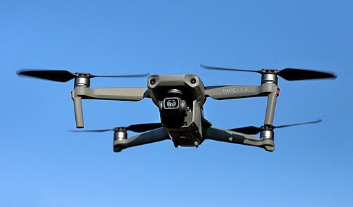
UgCS 5.11 now supports DJI Mini-series and other small drones (including Mini 4 Pro, Mini 3 Pro, Air 2S, and Spark) through integration with the Litchi app. Users can export missions from UgCS and fly them using Litchi on their mobile devices.
This new support gives operators more options, making it possible to use affordable and lightweight drones for advanced missions that were previously limited to larger platforms.
Multiple Map Overlays for Better Context
Another key improvement in UgCS 5.11 is the addition of multiple simultaneous map overlays. This feature allows planners to view infrastructure lines, hazard zones, and other reference data in one interface.
By combining different data layers, operators can plan flights in complex or regulated environments with greater confidence and situational awareness.
About UgCS
UgCS by SPH Engineering is a flight-planning software solution trusted by drone professionals in over 150 countries. It supports a wide range of popular drone platforms, including the DJI M350, M300, Mavic 3 Enterprise, Matrice 4 Series, and M600.
Unlike purely cloud-based tools, UgCS runs locally on PC and Mac. This setup offers full offline capabilities and a fast, 3D flight planning environment. UgCS is designed for advanced missions such as LiDAR surveys, photogrammetry, and corridor mapping.
Learn more about UgCS here.
Try UgCS Cloud here.
Use Mini-Drones with UgCS here.
Read more:


Miriam McNabb is the Editor-in-Chief of DRONELIFE and CEO of JobForDrones, a professional drone services marketplace, and a fascinated observer of the emerging drone industry and the regulatory environment for drones. Miriam has penned over 3,000 articles focused on the commercial drone space and is an international speaker and recognized figure in the industry. Miriam has a degree from the University of Chicago and over 20 years of experience in high tech sales and marketing for new technologies.
For drone industry consulting or writing, Email Miriam.
TWITTER:@spaldingbarker
Subscribe to DroneLife here.


