


New Partnership Enhances UAV Mapping Capabilities
ideaForge Technology Limited, an India-based global drone technology company, has announced a new partnership with Inertial Labs, a global leader in inertial sensors and GPS systems. This collaboration integrates Inertial Labs’ RESEPI LiDAR solution into ideaForge’s high-performance unmanned aerial vehicles (UAVs), representing a major step forward in UAV-based LiDAR mapping.
Addressing the Need for Accurate Aerial Data
The demand for precise aerial data collection and 3D mapping is growing across various sectors, including surveying, mapping, mining, construction, forestry, power line inspection, and search and rescue. This partnership aims to meet these needs by providing enhanced accuracy and reliability in data collection.
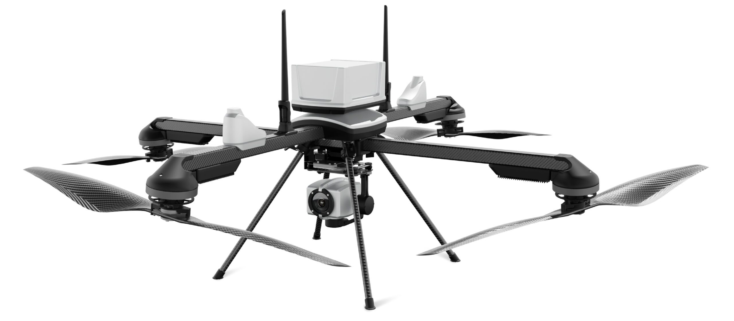
LiDAR technology offers significant potential for diverse applications in India’s varied landscapes. ideaForge and Inertial Labs will focus on providing solutions for mining, forestry, GIS and land surveys, and water resources management. The integration of Inertial Labs’ precise LiDAR payloads with ideaForge’s advanced NETRA/Q6 UAVs promises to deliver highly accurate aerial data quickly and efficiently.
Benefits of the Partnership
Ezhilan Nanmaran, Head of Product and Strategic Partnerships at ideaForge Technology Limited, said, “Our collaboration with Inertial Labs signifies a major leap forward in our UAV-based LiDAR mapping capabilities. This advancement enables us to achieve unparalleled precision and efficiency in data collection, revolutionizing mapping practices across agriculture, infrastructure, and environmental monitoring sectors. We are dedicated to driving innovation and offering our customers state-of-the-art solutions that expand the horizons of UAV-based LiDAR technology.”
The combined technology ensures users receive highly accurate and reliable data for mapping and surveying needs. The RESEPI LiDAR solution, integrated with ideaForge’s NETRA/Q6 UAVs, maintains high accuracy and point density at recommended flight altitudes. This makes it essential for various applications, such as:
- Mining Assessments: Precise stockpile volume calculations, slope stability analysis, and environmental impact assessments.
- Long-Range Surveying: High-density mapping with extended flight times and a lightweight design.
- Utility Infrastructure Management: High point cloud density and precision for capturing small details, including powerlines on transmission towers.
Key Specifications
| Feature | Description |
|---|---|
| One-man portable | MTOW <6kg |
| Multi-use platform | 27X Zoom, Thermal, Mapping, Multispectral, LiDAR |
| GCS software | Fully autonomous flying, built-in fail-safes for high wind, communication loss, GPS failure |
| Custom maps and terrain-following | Ensures accurate resolution in hilly areas/mines |
Jamie Marraccini, CEO at Inertial Labs, stated, “We are excited to partner with ideaForge, highlighting our commitment to industry advancement. In today’s fast-paced tech landscape, staying ahead is crucial. This collaboration combines our innovative technologies to deliver top-tier accuracy and reliability empowering users across diverse sectors.”
Enhanced Capabilities
The integration of LiDAR-based solutions into ideaForge’s UAVs is crucial for improving surveying and mapping capabilities. These UAVs will feature autonomous capabilities such as flight to predefined waypoints, automatic takeoff and landing, obstacle avoidance, fail-safe return to home, and the ability to fly at negative altitudes.
Read more: