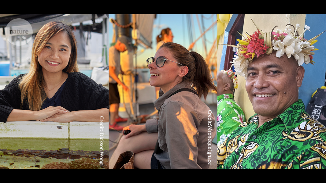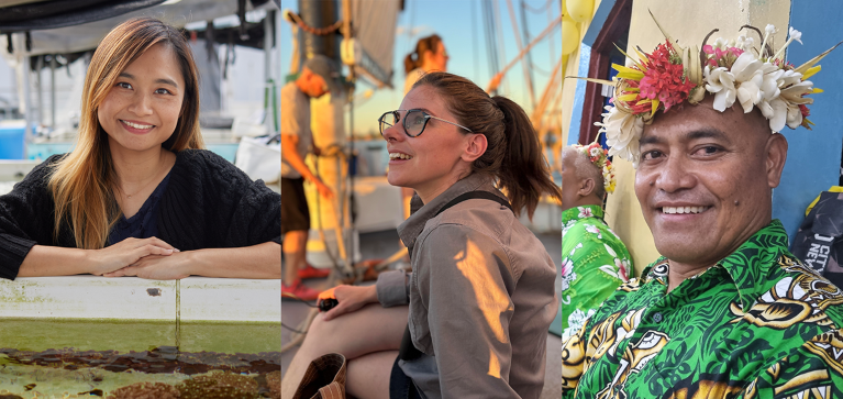
Apple Chui (left), Hannah Eisler Burnett (centre) and Taukiei Kitara study key issues for coastal communities.Credit: L: CPRO, The Chinese University of Hong Kong (Apple Chui), M: Véronëque Ignace (Hannah Eisler Burnett)
The best asset that a coastal area has in the fight against climate change is its people. Whether they’re building sea walls or coral nurseries, or helping to create rich records of flooding events and cultural artefacts, coastal locals are shoring up their neighbourhoods. Scientists Taukiei Kitara from Tuvalu, Hannah Eisler Burnett from New York City and Apple Chui from Hong Kong are working to ensure that the people dealing with coastal challenges have the advocacy, training and protection they need.
TAUKIEI KITARA: Island advocate
Sea levels in the Pacific are predicted to rise by 15 cm or more by the 2050s, regardless of global carbon-emission reductions. When this happens, parts of Tuvalu — a group of nine main islands midway between Hawaii and Australia — will vanish forever. “It’s going to be a significant loss for our people,” says Taukiei Kitara, who was born on Nui, a Tuvaluan atoll. Now based at Griffith University in Queensland, Australia, Kitara studies how climate change is impacting the culture, identity and sovereignty of small island states in the Pacific.
Nature Index 2025 Science cities
The effect on Tuvalu, which has an average elevation of less than 2 metres above sea level, is severe. Increasingly warmer waters have bleached corals and forced fishermen farther out to sea. Seawater has seeped into the water table, forcing Tuvaluans to grow swamp taro and other staple crops in raised garden beds rather than underground pits — a practice that dates back thousands of years. Rising sea levels are also eroding the coastlines. Kitara says that after his birth, half of his umbilical cord was buried under a newly planted coconut tree some 30 or 40 metres away from the ocean’s edge, as per Tuvaluan tradition. “Now it’s right on the coastline,” he says.
Moving is an option for some Tuvaluans. Australia offers visas for 280 Tuvaluans each year to migrate and obtain permanent residency under the 2023 Falepili Union Treaty — a first-of-its-kind ‘climate visa’ designed to aid climate-induced migration. More than 3,000 Tuvaluans (almost one-third of the nation’s population) have entered a ballot for the first release of visas. But many Tuvaluans aren’t keen on becoming climate refugees, says Kitara, whose research explores the potential impacts of the treaty.
In a 2023 opinion piece1, Kitara and Carol Farbotko, also from Griffith University, argued that migrants from climate-vulnerable Pacific nations are often framed in Australia as both ‘unskilled labour’ and ‘climate migrants’, which reinforces harmful stereotypes and puts them at risk of workplace exploitation. Kitara and Farbotko called for more just and compassionate labour and climate-migration policies inspired by the Tuvaluan value of fale pili — caring for others like family.
Those who have chosen to stay on Tuvalu are not giving up. The Tuvaluan government wants to bolster the country’s climate resiliency by “focusing on adaptation projects like land reclamation and raising the elevation of existing land”, says Kitara. Between 2017 and 2023, Tuvalu’s capital Funafuti was expanded by 5%, or 7.8 hectares, by dredging up sand from its lagoon. Sea walls were constructed on the outer islands of Nanumaga and Nanumea to protect some 2,780 metres of coastline from rising sea levels and storm surges.
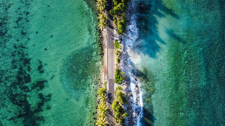
The narrowest part of Funafuti island, Tuvalu.Credit: Kalolaine Fainu/Guardian/eyevine
Tuvalu is also seeking refuge in a more unusual place: the metaverse. Since 2023, efforts have been under way to create a ‘digital twin’ of the island nation — a virtual reconstruction that includes details such as the locations of shops, houses and trees, as well as records of cultural artefacts, including recipes, dances, stories and memories. The project, which is being run by the Tuvaluan government in partnership with agencies in Australia, the United States and New Caledonia, started with Te Afualiku, Tuvalu’s smallest and most vulnerable island2. Te Afualiku features the most detailed reconstruction, but all nine main islands of Tuvalu, plus its dozens of smaller islands and islets, have now been mapped in three dimensions, and Funafuti has been digitally recreated using drone and street-level imagery.
Kitara says there are some concerns around data security and how energy-expensive the exercise is, but “there are good incentives” behind the initiative. “In the worst-case scenario, if every island disappeared, they’ll still exist digitally”, which will help to preserve national identity, culture, government functions, sovereignty and maritime rights, he says. As part of the project, Tuvalu received its first undersea cable, which will boost Internet and mobile connectivity for its residents once completed later this year.
Tuvaluans are “pretty vocal” about the need for climate action, Kitara says. But the impacts won’t stop at Tuvalu’s shores. “We’re all in the same boat,” says Kitara. “If we address the issue, it’s a win for us Tuvaluans, but also a win for everyone.” — Sandy Ong
HANNAH EISLER BURNETT: Flood watcher
Hannah Eisler Burnett knows first-hand the stresses of living in a flood-prone location. Having grown up on the Gulf coast of Mississippi in the southern United States, which was devastated by Hurricane Katrina in 2005, Burnett has dedicated her career to helping coastal communities build resilience to flooding caused by high tides, storm surges and groundwater inundation.
“Flood resilience comes from a variety of sources” beyond raising roads or elevating houses and flood-proofing basements, says Burnett. Behavioural changes such as organizing one’s neighbours to help clear a storm drain before a heavy rain event and building makeshift elevated paths through flood-prone areas are also important.
“In several of the communities I work with, one or two people are central for communicating ahead of potential flooding through e-mail, Whatsapp or Facebook groups, helping people understand what the local impacts of a high-tide flood or heavy rain might be,” says Burnett, an anthropologist at New York Sea Grant, an initiative run by the State University of New York and Cornell University. The programme is one of 34 government–university partnerships that link coastal research with community needs in the United States.
New York City, where Burnett now lives, is also vulnerable to flooding. Climate change is driving more frequent and intense hurricanes in the Atlantic, which is increasing the risk of major storm-driven flooding in the city. The water that flanks it has risen about 30 cm since 1900 — a rate twice the global average — and is projected to rise by just under 200 cm by 2100. Researchers have estimated that storm-driven flooding events could become up to four times more common along the US east coast, which puts 2.2 million New Yorkers in low-lying neighbourhoods such as Queens and southern Brooklyn at risk.
A core part of Burnett’s work involves building and maintaining a public database of flood photos called MyCoast for the Community Flood Watch Project, run by Sea Grant and the Science and Resilience Institute at Jamaica Bay in Brooklyn. The pictures, which are taken by members of the public across New York state, are used by the US National Weather Service to inform its messaging to local flood-management officials.
“The photos from MyCoast helped them understand that tidal/coastal flooding is more widespread than previously thought,” says Burnett. She adds that the database also provided “a big impetus” for policymakers in New York City to install 500 flood sensors across all five of the city’s boroughs in 2022, after realizing their value in early flood prediction.
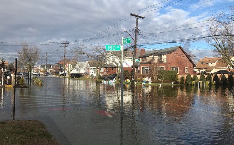
An image of a flooded street in Howard Beach, New York, submitted in 2024 to the MyCoast website, a tool for reporting coastal events such as storms and floods in selected US states.Credit: Theresa Miller/MyCoast
Last year, Burnett helped launch the Jamaica Bay Community Flood Fellowship Program, which provides a platform for leaders from different neighbourhoods in and around Jamaica Bay — a large coastal estuary on the southern edge of Brooklyn and Queens — to collaborate on solutions to chronic flooding. She also helps to familiarize community members with resources such as tide tables, which display the predicted times and heights of tides at specific coastal locations.
Burnett says it can be hard to convince some decision-makers that local insights — such as photos and interviews — are important in flood prediction. “A sensor can measure one thing, but a flood is something that’s happening in multiple dimensions,” she says.
At the same time, she praises how “innovative and clear-eyed” many residents, researchers and government agencies are when it comes to coastal resilience work. “New York City is a city of immigrants, who bring knowledge of flooding from many parts of the world and apply that knowledge in different ways,” says Burnett. Sandy Ong


