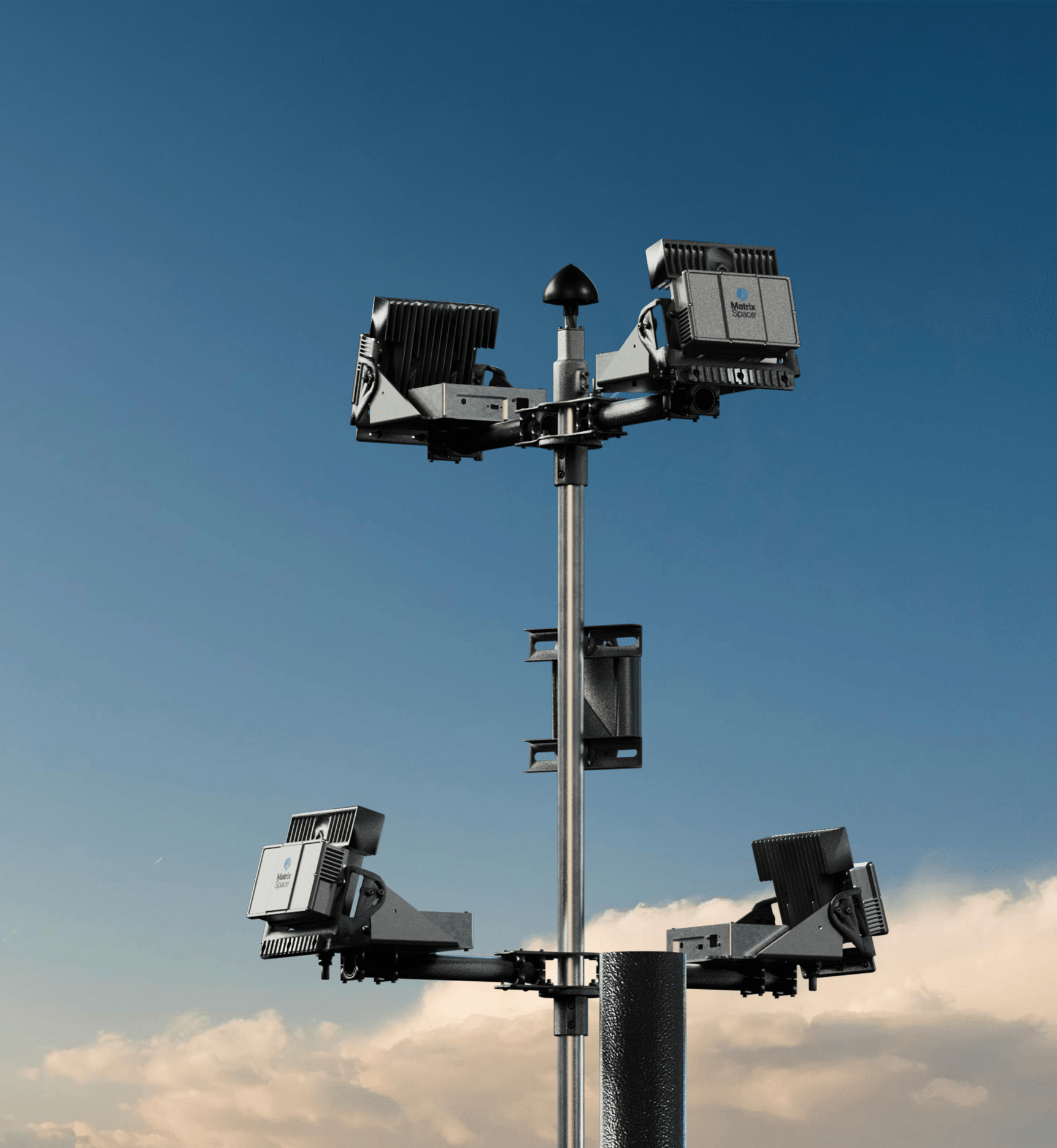
 The Palm Springs Police Department (PSPD) has taken a significant step forward in public safety innovation by expanding its Drone as First Responder (DFR) program. This enhancement establishes the largest radar-enabled municipal drone coverage area in the United States, spanning 37 square miles and eliminating the need for human visual observers during operations.
Radar-Powered Expansion
The PSPD’s expansion leverages MatrixSpace’s low airspace awareness technology, enabling drones to operate safely and efficiently without direct human oversight. This system supports the department’s application for a Federal Aviation Administration (FAA) waiver to conduct Beyond Visual Line of Sight (BVLOS) operations. Once approved, the waiver will allow PSPD drones to fly at night and in adverse weather conditions, further enhancing their capabilities.


Lieutenant William Hutchinson, who leads operations for PSPD, described the development as transformative: “Removing the need for a visual observer speeds up response time, dispatching drones in immediate response to incoming calls from multiple potential locations. Once we have our FAA waiver we can fly Beyond Visual Line of Sight (BVLOS) with just a single operator, with the ability to fly at night and in inclement weather.”
DFR Program Benefits
DFR programs like PSPD’s are designed to improve emergency response times and enhance situational awareness for law enforcement. Drones can assist with de-escalating incidents, locating missing persons, apprehending suspects, and providing critical aerial intelligence during emergencies. The expanded radar network ensures that drones operate safely alongside other air traffic, including flights from Palm Springs International Airport and medical or recreational aviation.


Palm Springs is a city of approximately 46,000 residents spread across 95 square miles. As a major tourist destination hosting nearly seven million visitors annually, the need for advanced public safety infrastructure is paramount. The radar-enabled network not only supports immediate law enforcement needs but also lays the groundwork for future applications such as regional public safety coordination, air taxis, and drone delivery services.
Technology Details: Radar for DFR
MatrixSpace’s 360 Radar sensors are compact yet powerful tools that provide reliable situational awareness in low-light and adverse weather conditions. These sensors enable PSPD drones to detect airborne and ground-based objects while ensuring safe operations during BVLOS flights. Additionally, the system offers counter-drone detection capabilities to address potential threats from unauthorized unmanned aircraft systems.
The current setup includes ten radar nodes distributed across Palm Springs, supporting three drone launch sites with plans for two additional locations. This network allows a single pilot to remotely operate drones from multiple points across the city.
Strategic Investment in Safety
Lieutenant Hutchinson emphasized that this initiative is fundamentally about improving public safety: “This project is first and foremost a strategic investment in the safety of our citizens. But I’m excited to explore possibilities for its use in other applications that could benefit the greater Coachella Valley.”
MatrixSpace Chief Revenue Officer Lori DeMatteis echoed this sentiment: “Palm Springs PD is at the forefront of fully utilizing DFR technologies to continually improve its capabilities. They also have a vision for scaling this beyond what other agencies have implemented, preparing for other operations which improve regional safety, and promote economic development.”
Looking Ahead
As PSPD continues to refine its DFR program with cutting-edge radar technology, it serves as a model for other municipalities seeking to integrate drones into their public safety operations. With FAA approval pending, Palm Springs is poised to set new benchmarks in drone-enabled emergency response and community safety.
Want DRONELIFE news delivered to your inbox every weekday? Sign up here.
Read more:

