Huntsville, AL — GeoCue, a global leader in 3D imaging and LiDAR technology, is pleased to
announce a new partnership with Latnet Technologies Ltd, which joins GeoCue’s expanding
distribution network as the latest provider of TrueView LiDAR solutions and LP360 software in
Canada. With this partnership, Canadian professionals in forestry, natural resource
management, utilities, mining, and urban planning will have local access to industry-leading
LiDAR solutions supported by Latnet’s renowned expertise and customer service.
Founded in 2023 by a team of seasoned surveyors with over 20 years of experience in
geospatial technology, Latnet Technologies Ltd has quickly established itself as a trusted
provider of UAV systems, geospatial equipment, and LiDAR mapping solutions. The company’s
clients include a wide range of industries, such as forestry, environmental agencies, utilities,
mining, urban planning, municipal governments, universities, and research institutions.
“We are thrilled to bring TrueView’s industry-leading LiDAR technology to Canada,” said Oskars
Kreilis, CEO of Latnet Technologies Ltd. “GeoCue’s TrueView products, coupled with the robust
LP360 software, deliver exceptional capabilities for Canadian professionals who demand
precision, versatility, and reliability in their data collection and analysis. By partnering with
GeoCue, we can offer our clients advanced solutions that meet our high standards for quality
and performance.”
Latnet Technologies’ commitment to customer support and training sets it apart, making them
an ideal partner to deliver GeoCue’s high-performance LiDAR solutions to the Canadian market.
Latnet offers personalized, one-on-one training sessions and conducts in-house testing for each
product, ensuring clients receive tailored recommendations and support.
Aaron Beach, GeoCue’s Western US Sales Manager, shared his excitement about the
partnership, emphasizing the value Latnet brings to the GeoCue distribution network.
“We’re excited to welcome Latnet Technologies to our network,” said Beach. “Their deep
industry knowledge, strong customer support, and commitment to quality align perfectly with
GeoCue’s mission. Together, we’re providing Canadian professionals with reliable LiDAR
solutions that drive data-driven insights and project success.”
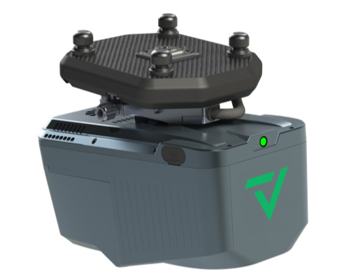
Latnet will be offering GeoCue’s full line of TrueView products, including the compact TV540
UAV solution, the versatile TV515 and TV535, the high-end TV720, and the innovative TV GO
handheld SLAM system. These solutions provide Canadian professionals with powerful, flexible
tools to meet the diverse needs of surveyors, engineers, environmental professionals, utility
operators, mining teams, urban planners, and more.
As Latnet Technologies Ltd continues to expand its offerings, it remains dedicated to advancing
its clients’ capabilities with cutting-edge geospatial technology and trusted local expertise. This
partnership with GeoCue allows Latnet to strengthen its commitment to delivering the best in
LiDAR and mapping solutions to Canada’s growing geospatial market.
About Latnet Technologies Ltd.
Latnet Technologies Ltd., based in Calgary, is a trusted provider of high-quality survey
equipment and solutions tailored to the geospatial measurement and mapping industries.
Specializing in advanced surveying tools, Latnet offers a comprehensive product range to meet
the needs of professional surveyors, engineering firms, and construction teams. With a team of
experts who bring years of experience and a deep understanding of the industry’s unique
demands, Latnet is committed to delivering reliable, high-precision equipment and exceptional
customer support for accurate, efficient data collection.
To learn more about latent Technologies Ltd. visit www.latnet.ca/
About GeoCue
GeoCue brings geospatial experts the very best in drone, mobile and land surveying equipment,
geospatial point cloud software, workflow, training, and support for high-accuracy LiDAR and
Imagery mapping to help civil engineering and surveying professionals achieve successful data
collection, processing, and management.
With TrueView LiDAR/Imaging sensors and LP360 point cloud data processing software we are
the leader in LiDAR mapping processing in North America able to meet customers where they
are in terms of technology adoption, budget, and resources.
To learn more about GeoCue, visit www.geocue.com
Related
Discover more from sUAS News
Subscribe to get the latest posts sent to your email.


