 New Features Aim to Streamline Military and Commercial Mapping Operations
SimActive Inc. has announced the release of Correlator3D™ Version 10.2, introducing significant upgrades designed to improve productivity and reduce editing time for both military and commercial users. The latest version of Correlator3D™ offers a comprehensive overhaul of mosaic and point cloud editing tools, which aim to save time and enhance user experience.
Streamlined Mosaic and Point Cloud Editing: Correlator3D Version 10.2
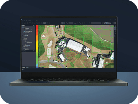
The most notable improvement in Correlator3D Version 10.2 is the complete redesign of mosaic editing tools. These enhancements are tailored to significantly reduce the time and effort required for post-process editing. The new tools offer a more intuitive interaction with seamlines, allowing users to apply modifications in real-time. Additionally, the introduction of visual aids enhances the overall user experience.
The update also includes new point cloud editing tools, which further streamline the output, reducing the need for extensive post-processing. Users now have the ability to specify which ortho image to use from the available options over a given scene. This feature is particularly useful for removing vehicles or selecting the best nadir image to achieve a more refined output mosaic.
“The new mosaic editing tools in Version 10.2 are a real game changer in terms of productivity and cost reduction,” said Louis Simard, CTO at SimActive. “Version 10.2 reduces time spent editing, with both mosaics and point clouds using our refined tools.”
A Legacy of Technological Innovation
Since its inception, SimActive has continuously adapted its software to keep pace with technological advancements. Initially developed for large-format cameras on aircraft, Correlator3D™ was later adapted for satellite processing and drone imagery. This adaptability has allowed SimActive to remain at the forefront of geospatial data processing, offering tools that integrate data from various sources, including drones, manned aircraft, and satellites.
“Our software accepts imagery regardless of the platform it is captured on. Imagery from any of the formats can be combined to allow for rapid processing of areas of interest,” said Philippe Simard, CEO of SimActive.
The versatility of Correlator3D™ has proven invaluable in military and commercial operations, particularly in scenarios requiring rapid data processing and integration. For instance, during disaster response efforts following Hurricane Irma, the French military used drones to capture and process ortho imagery on-site. This data was then utilized to assess damage and aid in recovery operations.
As the demand for fast, flexible, and user-friendly mapping solutions grows, SimActive’s Correlator3D™ continues to provide the tools needed to meet the challenges of modern military and commercial operations. With its latest release, SimActive reinforces its position as a leader in geospatial data processing.
Read more:
Miriam McNabb is the Editor-in-Chief of DRONELIFE and CEO of JobForDrones, a professional drone services marketplace, and a fascinated observer of the emerging drone industry and the regulatory environment for drones. Miriam has penned over 3,000 articles focused on the commercial drone space and is an international speaker and recognized figure in the industry. Miriam has a degree from the University of Chicago and over 20 years of experience in high tech sales and marketing for new technologies.
For drone industry consulting or writing, Email Miriam.
TWITTER:@spaldingbarker
Subscribe to DroneLife here.

