


SimActive’s Correlator3D™ software is being used for real-time mapping on construction projects.
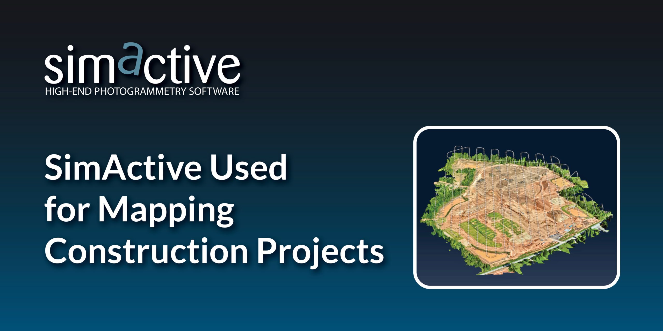
SimActive Inc. has announced that its photogrammetry software, Correlator3D™, is being used by Bullseye Construction to map large-scale construction projects. This collaboration allows Bullseye Construction to generate highly accurate map products such as digital surface models (DSMs), point clouds, and orthomosaics. By leveraging drone technology, Bullseye Construction can map and track the progress of its projects throughout all stages of construction.
Chris Greene, UAS Manager at Bullseye Construction, emphasized the importance of using advanced software to stay within project budgets. “From start to finish, we are continuously mapping to keep the overall project within budget,” Greene stated. “We use Correlator3D exclusively, as it has always proven to be the fastest and most accurate mapping solution available.”
Continuous Monitoring with Drones
Bullseye Construction operates its own fleet of drones, which it deploys at each of its construction sites. These drones capture data on an ongoing basis to monitor the movement and relocation of materials. The data collected ensures that the firm can make accurate estimates and adjust as needed during the building process. By providing a constant flow of detailed information, Bullseye’s project managers are able to make informed decisions quickly, which helps in avoiding delays and keeping the project on track.
SimActive’s Photogrammetry Software
SimActive is a developer of cutting-edge photogrammetry solutions, and its Correlator3D™ software is widely used in both commercial and government applications. Correlator3D™ is known for its high-speed processing capabilities and its ability to deliver precise geospatial data. The software allows users to create a range of outputs from satellite and aerial imagery, including DSMs, digital terrain models (DTMs), and 3D models. The technology’s scalability and speed make it ideal for large-scale projects like those undertaken by Bullseye Construction.
SimActive has been providing mapping firms with reliable software since its founding, and it continues to push the boundaries of geospatial data processing with GPU-powered and multi-core CPU technology.
For more information on SimActive, visit SimActive’s website. For details on Bullseye Construction, visit BullseyeConstruction’s website.