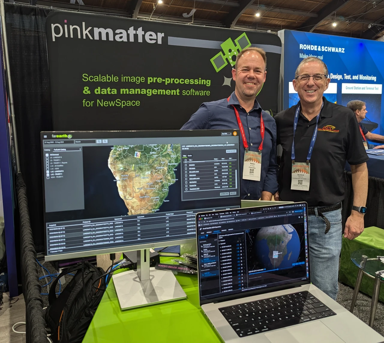
Ascending Node Technologies, a leading developer of collaborative mission management solutions, and satellite sensor calibration and image processing specialist Pinkmatter today announced a strategic alliance to help ensure smallsat Earth observation (EO) missions in low Earth orbit (LEO) get the accurate scientific data they need from space.
The collaboration will ensure that observation satellites traveling at 29,000 kilometers-per-hour can leverage Ascending Node Technologies’ Spaceline® suite of web-based data analysis, geometrics, and visualization tools to rehearse and simulate fly-overs days, weeks, even months in advance of performing the actual precision observation of a specific target on Earth.
The raw observation data is then sent from the satellite to Pinkmatter’s cloud-based FarEarth software, which will perform sensor calibrations and automatically process and correct raw downlinked data into map-ready imagery that is stored in a user-friendly archive.
The accuracy of the ANT’s Spaceline observation scheduling and simulations together with the ability of Pinkmatter’s FarEarth system to create high-quality image products that provide continuous sensor calibration and satellite performance monitoring delivers EO mission success.
The combination of complementary capabilities gives Earth observation teams the confidence they need to invest in developing, launching, and flying game-changing missions that will deliver accurate and defining observations that come with the best automated visualization technologies and calibration solutions in the industry.
“A picture is worth a thousand words, but only if your mission has the scientific scheduling and processing capabilities to deliver accurate imagery and data that your observation team set out to capture with a spacecraft scanning across the Earth’s surface at eight kilometers-per-second,” explains Sanford Selznick, chief software architect for Ascending Node Technologies. “Our collaboration with Pinkmatter enables Earth observation missions of all sizes to successfully schedule and execute their critical operations using Spaceline® to make the most of their incredibly short, split-second timing windows for optimal imagery.”
“This alliance between Pinkmatter and Ascending Node Technologies focuses on Earth observation
missions, providing the essential steps from acquisition planning to producing image products ready for downstream analytics. Pre-processing is essential for small satellites and FarEarth does this all at scale,” said Stefan de Klerk, Pinkmatter’s Chief Commercial Officer.
More than one-thousand observation satellites are orbiting the Earth today, and many will fail to gather the mission-critical imagery they need due to flight path miscalculations that cause camera-equipped spacecraft to miss their intended targets. Operational mistakes can prove very costly, given the price of building and launching observation satellites and the immeasurable losses resulting from unusable or inaccurate imagery for critical missions, such as monitoring coastal erosion, suburban sprawl, crop harvest comparisons, or an adversary’s position.
About Ascending Node Technologies
Founded in 2018, Ascending Node Technologies, LLC develops collaborative space mission management solutions and technologies that allow mission operators and their widely dispersed teams to collaborate in real-time to increase operational efficiencies and flight plan accuracy and reduce mission risk. The company’s flagship solution, Spaceline®, is a revolutionary web-based interactive 3D visualization platform that leverages telemetry-based data to provide precision flight planning at every mission stage. Spaceline is designed to support virtually any space mission imaginable, including space situational awareness and collision avoidance initiatives, orbital debris removal, deep space exploration, and lunar and cislunar development, to name a few.
For more information about the Spaceline visualization platform and Ascending Node Technologies, visit www.ascendingnode.tech
About Pinkmatter
Pinkmatter has deep roots in the space industry. We have decades of experience developing large ground segments for space agencies and remote sensing analytics applications globally. With FarEarth for SmallSats, we bring our expertise to NewSpace.
Our automated subscription-based cloud platform calibrates and processes data for EO constellations. Our software brings to New Space companies what teams of scientists bring to large classic space missions.
FarEarth creates imagery with scientific value. If you want more than a pretty picture, you must correct for a small satellite’s limitations with sound scientific principles. FarEarth is the essential step between acquisition and downstream analytics. FarEarth produces terrain-corrected, map-ready products in industry-standard formats. Our product quality reports and metadata provide traceability and peace of mind.
Our volume-based annual subscription makes it easy to manage your financial risk. Grow from pathfinder to constellation while only paying for what you need at each stage. The subscription covers all phases of your project.
We have worked with various sensor manufacturers and satellite integrators through all mission phases.
For more information about Pinkmatter, visit www.pinkmatter.com
Related
Discover more from sUAS News
Subscribe to get the latest posts sent to your email.


