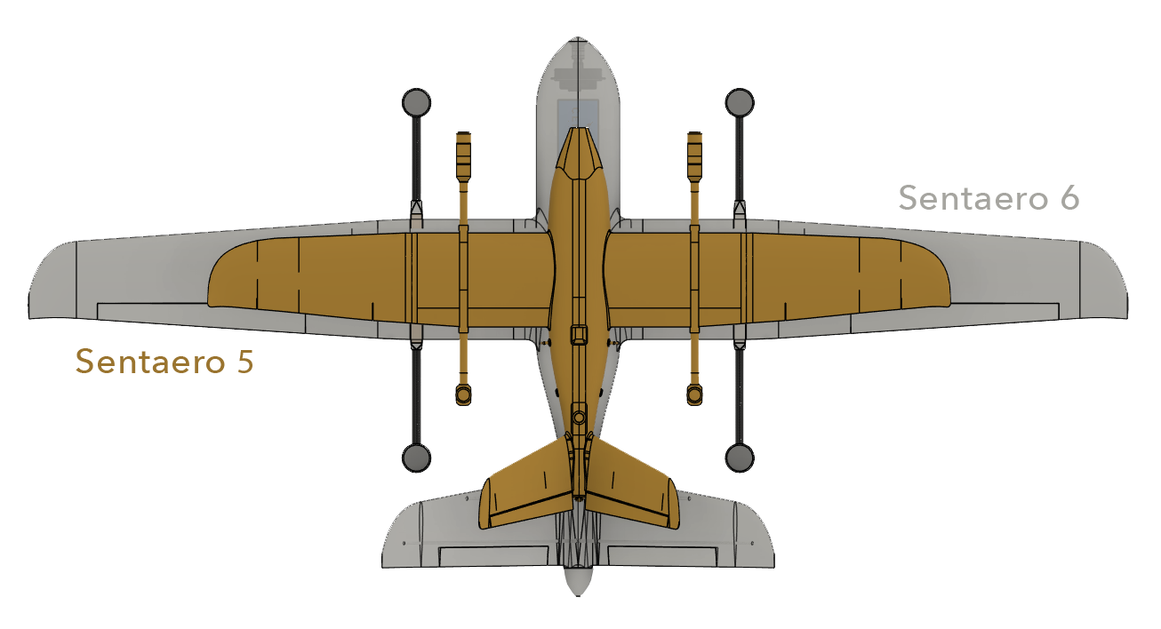
In the journey to make commercial Over the Horizon Beyond Visual Line of Sight (OTH BVLOS) common, Censys Technologies is proud to announce Sentaero 6, a drone system engineered with customer feedback and regulatory expertise. This effort is a testament to their mission to enrich lives through asset intelligence and commitment to produce peerless value manufactured in America.
Starting in 2021, Censys Technologies has gone from 3-mile geo-constrained BVLOS approvals using visual observers to nationwide BVLOS approvals where the Sentaero 5 can be flown out to 40 miles in one-way operations without using visual observers. Censys Technologies continuously works to push OTH BVLOS in the United States forward through aircraft design and collaboration with the FAA.
“Now, the Sentaero is in a position of regulatory acceptance where operators can truly capture the value and efficiency of OTH BVLOS operations,” explained Rob Knochenhauer, Director of Regulatory Affairs. “What our clients and the industry need is a more capable aircraft to best capitalize on this trend. That’s why we developed Sentaero 6.”
For decades, end users have been chained to a one-crewed-aircraft-one-pilot capability for OTH inspections, mapping, and surveying. Along with the human resource needs, availability and proximity of airports have been major deployment constraints. The Sentaero 6 shatters the chains with superior economics and closes the capabilities gap with a 2-hour endurance, expanded payload capacity over predecessors, native artificial intelligence integration, and 90-mile C2 range*. These upgrades empower operators to take on larger, advanced missions more frequently, providing them with up-to-date information on the condition of their assets.
The Sentaero 6 concept of operations will be expanded in the months to come to include swarm (one human, many aircraft) and fully remote operations, driving an unparalleled data collection rate and quality combination. In a continued effort to improve safety and reliability, several single-point failure points have been eliminated and an ASTM-certified parachute for urban missions was implemented.
With the increase in capability comes the increase in the quantity of data which is why Sentaero 6 is designed with an onboard computer. This enables the company’s CensWise, an easy-to-use AI/ML software platform, to start processing data into intelligence while airborne.
“At Censys Technologies, we’re working to bring our customers closer to omniscience, and the Sentaero 6 is a testament to our resolve,” said Trevor Perrott, CEO of Censys Technologies. “With this platform, we’re not just offering a drone; we’re providing a comprehensive solution that acquires data, converts it to an intelligence dashboard, and enables users to prevent and solve problems at an accelerated pace.”
The Sentaero 6 is now available for preorder. For more information about the Sentaero 6 and how it can elevate your operations, visit www.censystech.com or contact us at [email protected].
*C2 (command and control) range is dependent on available cellular service.
About Censys Technologies
Censys Technologies is transforming the way businesses and governments operate by delivering asset intelligence through the development and production of advanced uncrewed aerial system, Sentaero, coupled with custom, easy to use CensWise AI/ML software. With a commitment to innovation, quality, and customer service, we are changing the way critical asset data is collected and analyzed.
Related
Discover more from sUAS News
Subscribe to get the latest posts sent to your email.


