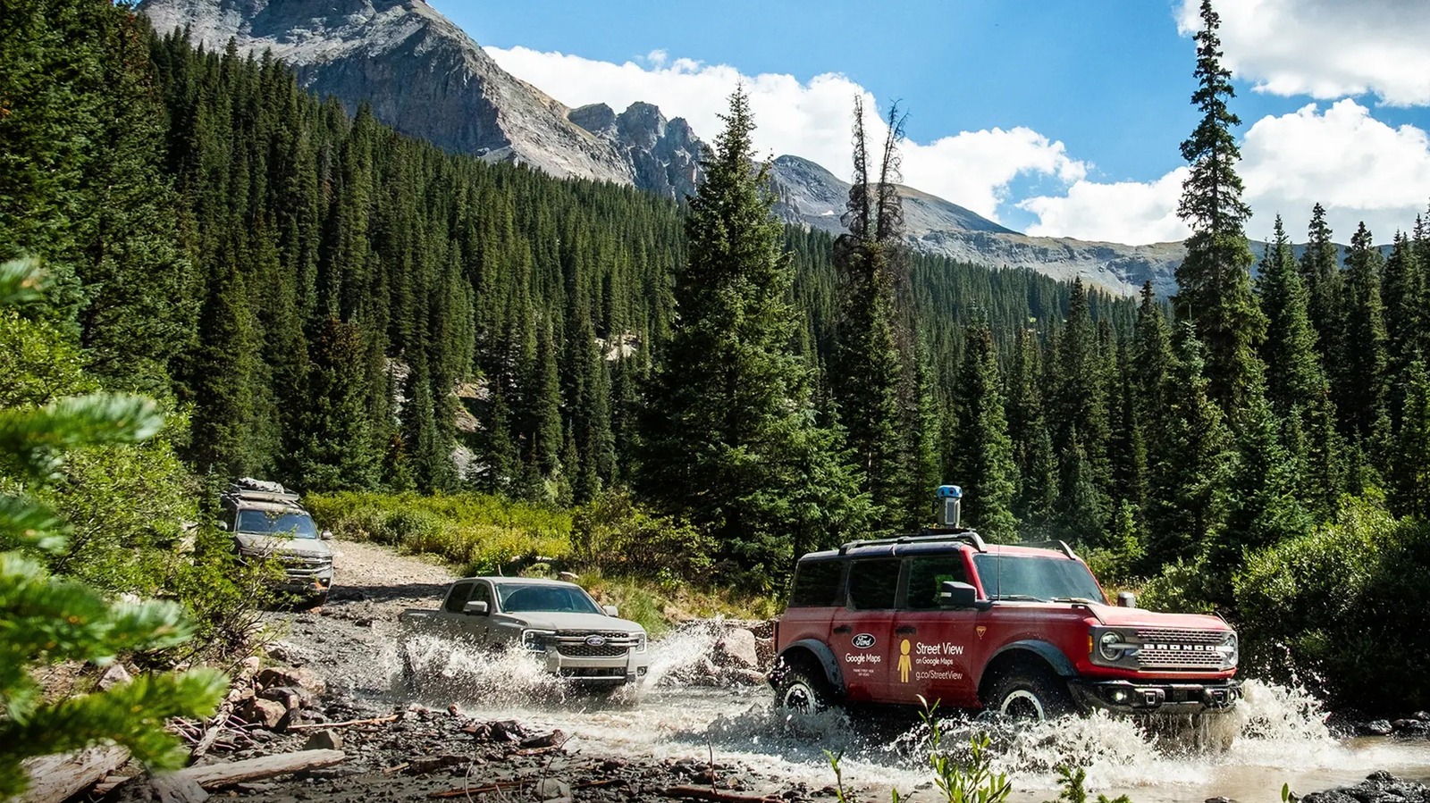
Google Street View covers most accessible areas of the world, as well as a few special places like race tracks, museums, and even the International Space Station. Ford saw an opportunity to help bring the TransAmerica Trail to device screens everywhere. Google’s current Street View camera weighs just 15 pounds and will fit any car with a roof rack, so Ford attached one to a Bronco Badlands to bring the entire TAT to Street View. A Ranger Lariat and Expedition Tremor joined the Bronco as support vehicles.
For those who aren’t aware, the TransAmerica Trail is more than 5,900 miles long. It travels through 13 states, from Port Orford, Oregon, to Nags Head, North Carolina, with the guiding principle of avoiding pavement wherever possible. Created by Sam Correro to pursue and share his passion for off-road motorcycling, adventure riders, side-by-sides, and overland enthusiasts now enjoy the TAT as well. People who prefer to stay closer to home can still enjoy the portions of the TAT that pass through their local areas. The Ford team started in Port Orford and spent 32 days driving and documenting the TransAmerica Trail. That sounds like a dream work trip to me.
A snapshot in time
To see how well Ford did for myself, I looked up the Oark Cafe, one of my regular motorcycle destinations that’s not only right on the TAT but that the TAT website considers “a must-stop.” It’s in the middle of nowhere in the Ozarks of Arkansas, with many fun paved and dirt roads in the area, and about half an hour from the Pig Trail. It’s a place that Street View has never touched before, but now shows the Oark in all its glory. Travelers can now look it up on Street View ahead of time to know what it looks like when they get there. That goes for any other point of interest on the TAT, making Street View a useful tool for serious scouting or simply sightseeing.
While Ford’s effort is an excellent representation of what you can expect along the TAT, keep in mind that the route changes slightly over time. Everything from regular wear and tear to natural disasters can mean that roads and trails that were challenging 20 years ago may be impassible today, requiring a different, but still exciting, way to get through. As the TAT continues to change, its Street View images will remain in August 2025 unless Ford (or someone else) decides to map it again in the future. The definitive source of the actual route is the TransAmerica Trail website. While sightseeing through Street View is fun and allows anyone to see the TAT’s wonders, use the official maps, roll charts, and GPS tracks if you intend to explore it yourself.

