

Testing Portable Airspace Management Systems for Safer, More Effective Aerial Firefighting
NASA is working with the wildfire response community to develop new technologies that will enhance aerial firefighting operations, particularly at night. These advancements could enable drones, both remotely piloted and autonomous, to assist in wildfire suppression around the clock, even in low-visibility conditions.

Enhancing Aerial Firefighting with Autonomous Technologies
Currently, aerial firefighting is limited to daylight hours when pilots have clear visibility. Nighttime operations pose significant risks due to potential collisions with terrain or other aircraft. To address this challenge, NASA has been testing airspace management technologies that allow drones and remotely piloted aircraft to operate safely at night.
In an article posted by NASA, the project manager explains:
“We’re aiming to provide new tools – including airspace management technologies – for 24-hour drone operations for wildfire response,” said Min Xue, project manager of the Advanced Capabilities for Emergency Response Operations (ACERO) project within NASA’s Aeronautics Research Mission Directorate. “This testing will provide valuable data to inform how we mature this technology for eventual use in the field.”
Introducing the Portable Airspace Management System (PAMS)
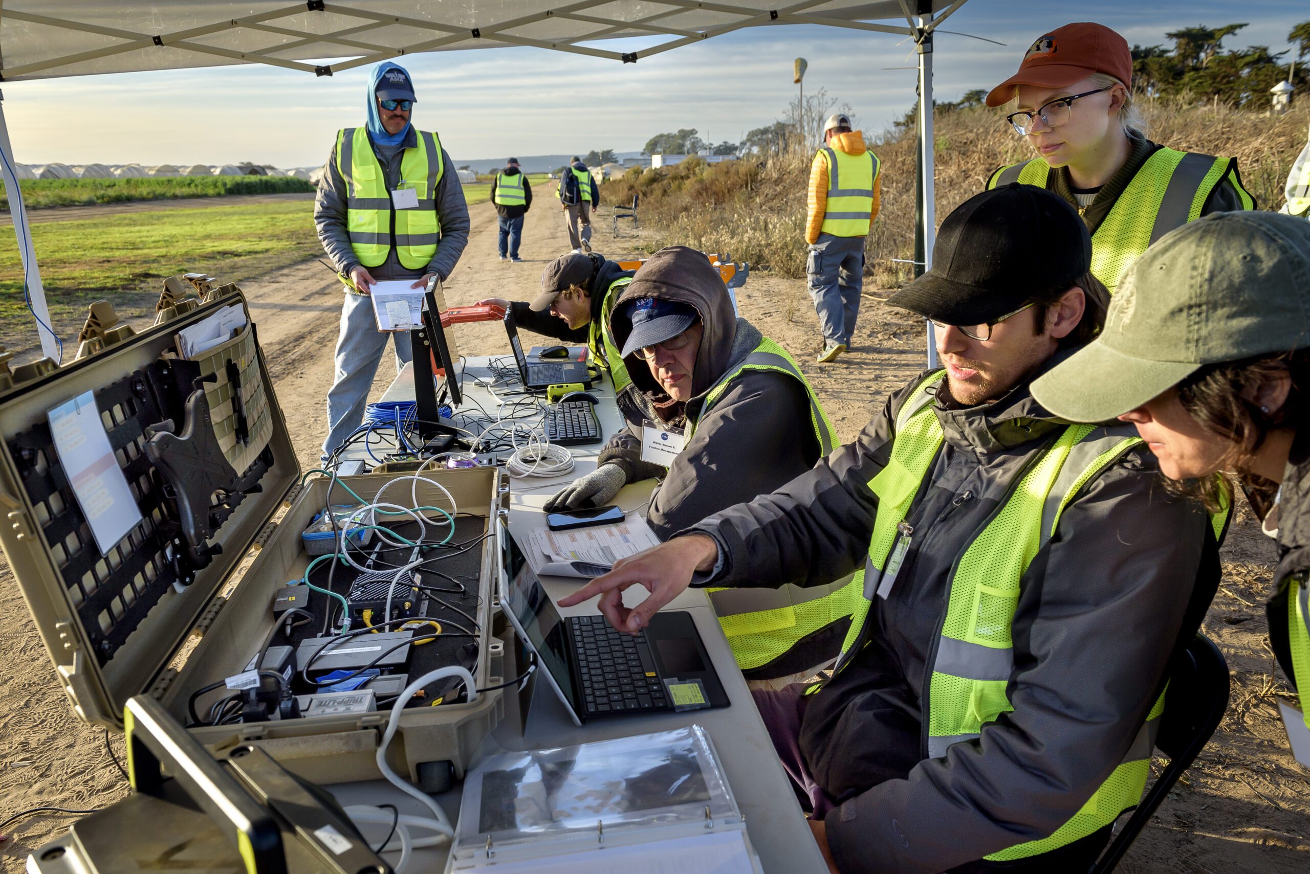
Over the past year, ACERO researchers have developed the Portable Airspace Management System (PAMS), designed to help drone pilots safely deploy aircraft for wildfire response. Each PAMS unit, about the size of a carry-on suitcase, is equipped with:
- A computer for airspace management
- A radio for communication among PAMS units
- An Automatic Dependent Surveillance-Broadcast (ADS-B) receiver to track nearby air traffic
These components are housed in a rugged, portable container, making the system easily deployable in the field. The PAMS software helps drone pilots prevent airborne collisions by monitoring and sharing flight plans with other aircraft in the network. Additionally, it provides essential fire location and weather information.
A key feature of the system is an airborne communication relay. A drone equipped with a communication device serves as a relay between ground-based PAMS units, enabling communication without relying on internet connectivity.
Successful Testing at Multiple Locations
To evaluate PAMS’ effectiveness, NASA researchers conducted a series of tests at various locations across the country.
At NASA’s Ames Research Center in California’s Silicon Valley, three PAMS units were placed in different locations outside each other’s line of sight. Researchers entered flight plans into each system and confirmed that the units successfully shared information through a mesh radio network.
The team then expanded testing at NASA’s Langley Research Center in Hampton, Virginia. A long-range vertical takeoff and landing (VTOL) aircraft equipped with a camera, computer, mesh radio, and ADS-B receiver was flown alongside two smaller drones. These tests demonstrated that the mesh radio network aboard the larger drone successfully connected with the small drones and multiple ground-based PAMS units.
Simulating Real-World Firefighting Operations
Further testing took place at Monterey Bay Academy Airport in Watsonville, California, where researchers simulated real-world firefighting scenarios. A winged VTOL drone by Overwatch Aero established a communications relay to three separate PAMS units. Two additional drones were flown nearby, with pilots intentionally submitting conflicting flight plans and operating outside preapproved zones.
The PAMS units successfully detected these conflicts, alerted pilots, and shared real-time aircraft location, weather updates, and simulated fire location data. These results suggest that PAMS can significantly improve aerial coordination during wildfire operations.
“This testing is a significant step towards improving aerial coordination during a wildfire,” Xue said. “These technologies will improve wildfire operations, reduce the impacts of large wildfires, and save more lives.”
Looking Ahead
The ACERO team plans further flight evaluations this year to refine these wildfire technologies. The ultimate goal is to transfer the technology to firefighting agencies to enhance their operational capabilities.
This initiative is part of NASA’s broader efforts under the ACERO project, which operates within the agency’s Aeronautics Research Mission Directorate and supports the Advanced Air Mobility mission.
For more details on NASA’s ACERO project, visit NASA. More information on Overwatch Aero can be found at Overwatch Aero.
Want DRONELIFE news delivered to your inbox every weekday? Sign up here.
Read more:

Miriam McNabb is the Editor-in-Chief of DRONELIFE and CEO of JobForDrones, a professional drone services marketplace, and a fascinated observer of the emerging drone industry and the regulatory environment for drones. Miriam has penned over 3,000 articles focused on the commercial drone space and is an international speaker and recognized figure in the industry. Miriam has a degree from the University of Chicago and over 20 years of experience in high tech sales and marketing for new technologies.
For drone industry consulting or writing, Email Miriam.
TWITTER:@spaldingbarker
Subscribe to DroneLife here.