Tracking methane emissions accurately is crucial for shaping environmental policies and regulations. This colourless and odourless gas, which is the main component of natural gas and a potent greenhouse gas, is emitted from a variety of sources, including oil drilling and farming. But finding and quantifying it is inherently challenging.
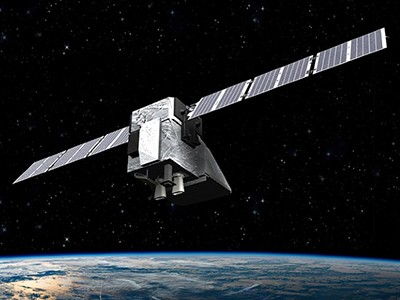
A reliable system urgently needs to be put in place for methane monitoring. And there has been a lot of buzz lately around using satellites. In March, the MethaneSAT satellite was launched for this purpose. Some are heralding this technology as the next big thing in environmental monitoring.
How AI is improving climate forecasts
As someone who has spent decades working on satellite systems, I can appreciate the allure. Satellites offer the ability to cover vast expanses of land, capturing data from regions that are difficult to monitor by other means.
But, before we get too carried away, it’s worth pausing to consider what satellites can — and, more importantly, cannot — do. Although satellites can provide crucial insights into methane releases, they are not a comprehensive solution. Their effectiveness is often hampered by limited spatial resolution, atmospheric interference and the challenge of accurately identifying specific emission sources.
Satellites’ broad spatial coverage tends to come at the cost of precision. Take the Permian Basin — a prolific oil- and gas-producing area in the southwestern United States. Overlapping infrastructure, such as pipeline networks and storage facilities, combined with varying topography, fluctuating weather patterns and diverse land uses, make specific emission sources hard to pinpoint.
Weather patterns can distort satellite readings, and offshore emissions are frequently missed. Given that oceans cover more than two-thirds of our planet, this is no small oversight.
This methane-sniffing satellite will leave climate polluters nowhere to hide
My experience managing large-scale satellite projects has taught me that remote-sensing data can sometimes raise more questions than they answer. This underscores the need for complementary monitoring methods.
To verify findings and identify leaks, satellites must be paired with boots on the ground. Relying too heavily on satellite data without corroborating it risks painting an incomplete — and possibly inaccurate — picture. And modelled data should not replace on-the-ground observations.
Such a multifaceted strategy can enhance the precision of methane monitoring, meaning that decisions are based on accurate and thorough data. More must be done to ensure that global players are investing in and deploying the most accurate methods, and are placing funding intentionally behind the technology that works best.
That means taking a more realistic approach to missions such as MethaneSAT, which is a collaboration including the US Environmental Defense Fund, Harvard University in Cambridge, Massachusetts, and the New Zealand Space Agency. MethaneSAT represents a technological upgrade over previous satellites for monitoring methane. These include GHGSat, a series of satellites that monitor carbon dioxide and methane from industrial sources, and the European Space Agency’s Sentinel-5 Precursor, which is part of the Copernicus programme and equipped to detect various atmospheric gases. Nonetheless, several challenges can affect its data.
Cloud and weather conditions can mask emissions and measurements cannot be performed at night. Emissions are hard to attribute to specific sources in densely populated areas, and data processing and interpretation challenges hinder detection in areas with dense forests or at high latitudes, where reduced sunlight reflection complicates measurements.
Scientists raise alarm over ‘dangerously fast’ growth in atmospheric methane
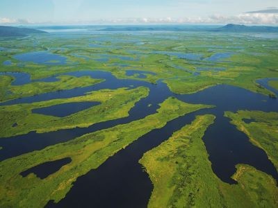
MethaneSAT is unable to measure methane emissions over water bodies, although plans are under way to enhance its capabilities to monitor offshore methane emissions by observing sunlight glinting on the water’s surface. And for agriculture, there can be difficulties in distinguishing between emissions from livestock and those from wetlands.
To enhance MethaneSAT’s accuracy, its data should be integrated with ground and aerial efforts. Ground teams and permanent monitoring stations can verify emissions, and drones and aircraft provide detailed coverage in challenging areas. Better algorithms and machine learning could fuse satellite, aerial and ground data for more precise emission attribution. Technological advances would allow night-time and offshore detection.
Thus, the real work happens on the ground, where problems are actually solved. The US oil and natural-gas industry, for example, is working with the best minds to accelerate innovative technologies, including satellites, to detect and mitigate its methane emissions. It is also deploying response teams on the ground to quickly find and repair any leaks.
Ultimately, my concern is that in our rush to embrace satellite monitoring, we end up missing the real picture. Methane detection is complex and no single technology can cover every angle. To make a difference, we need a balanced approach — one that values both the sweeping view from above and the granular, precise work done on the ground. Because, at the end of the day, methane monitoring is too important to leave to one tool alone. Let’s make sure we get this right.


