


This white paper presents the results of an aerial survey of the historic San Miguel Mission site in California, conducted using the IF800 Tomcat drone equipped with a Sony ILX-LR1 camera and a 35 mm lens. The mission’s objective was to create an orthomosaic map of the site, capturing high-resolution imagery that could be used for historical documentation, conservation, and potential restoration efforts. The drone completed the mission with 490 images captured at 61 megapixels at an altitude of 60 meters, producing a high-quality dataset for post-processing. The total flight duration was 34 minutes, landing with a 20% battery reserve. The data obtained in this survey will serve as a crucial tool for preserving the integrity of this historically significant site.
Introduction
The Mission San Miguel Arcángel, founded in 1797, is a significant cultural and historical landmark located in San Luis Obispo County, California. Its preservation and documentation are crucial for future generations to understand the architectural and cultural heritage of early Californian settlements. Leveraging modern drone technology provides an efficient and non-invasive way to capture detailed, high-resolution data that can aid archaeologists, conservators, and historians in their efforts to safeguard this site.
In this mission, an advanced aerial survey was conducted using the IF800 Tomcat drone. This platform, combined with a Sony ILX-LR1 camera, was chosen for its ability to carry heavier payloads and maintain stable flight in mission-critical environments.
2.jpg)
Mission San Miguel Arcángel from the southeast, circa 1904
Objectives
The primary objective of this mission was to:
- Capture high-resolution aerial imagery of the San Miguel Mission site for the purpose of creating an orthomosaic map.
- Document the current condition of the site using non-invasive aerial methods.
- Provide accurate spatial data that could assist future archaeological and preservation projects.
Mission Details
Equipment Used
- Drone Platform: IF800 Tomcat
- Camera: Sony ILX-LR1 with a 35 mm lens
- Altitude: 60 meters above ground level (AGL)
- Image Count: 490 images
- Image Resolution: 61 megapixels
- Flight Time: 34 minutes (landing with 20% battery reserve)
Ground Sample Distance (GSD)
The Ground Sample Distance (GSD) is a crucial metric in aerial mapping as it defines the spatial resolution of the images captured. For this mission:
- The 35 mm lens and 61-megapixel sensor, flown at an altitude of 60 meters, provided a GSD of approximately 0.9 cm/pixel.
- This high level of detail is suitable for generating an extremely accurate orthomosaic map, capable of distinguishing fine features on the ground, such as cracks, weathering, and structural details of the site.
Flight and Image Capture
The mission was flown with careful pre-flight planning to ensure complete coverage of the site. The drone followed a grid pattern with 80% overlap between images, ensuring that all areas of the site were well-documented with enough redundancy for accurate 3D reconstruction and photogrammetry. The IF800 Tomcat performed well, providing stable flight, and completing the mission with a 20% battery reserve, showcasing the endurance of the drone and its suitability for long-duration flights in mission-critical operations.
Data Processing
The 490 images were stitched together using advanced photogrammetry software to create a high-resolution orthomosaic map of the site. This map provides an accurate, geo-referenced visual of the entire area, suitable for detailed analysis and record-keeping.
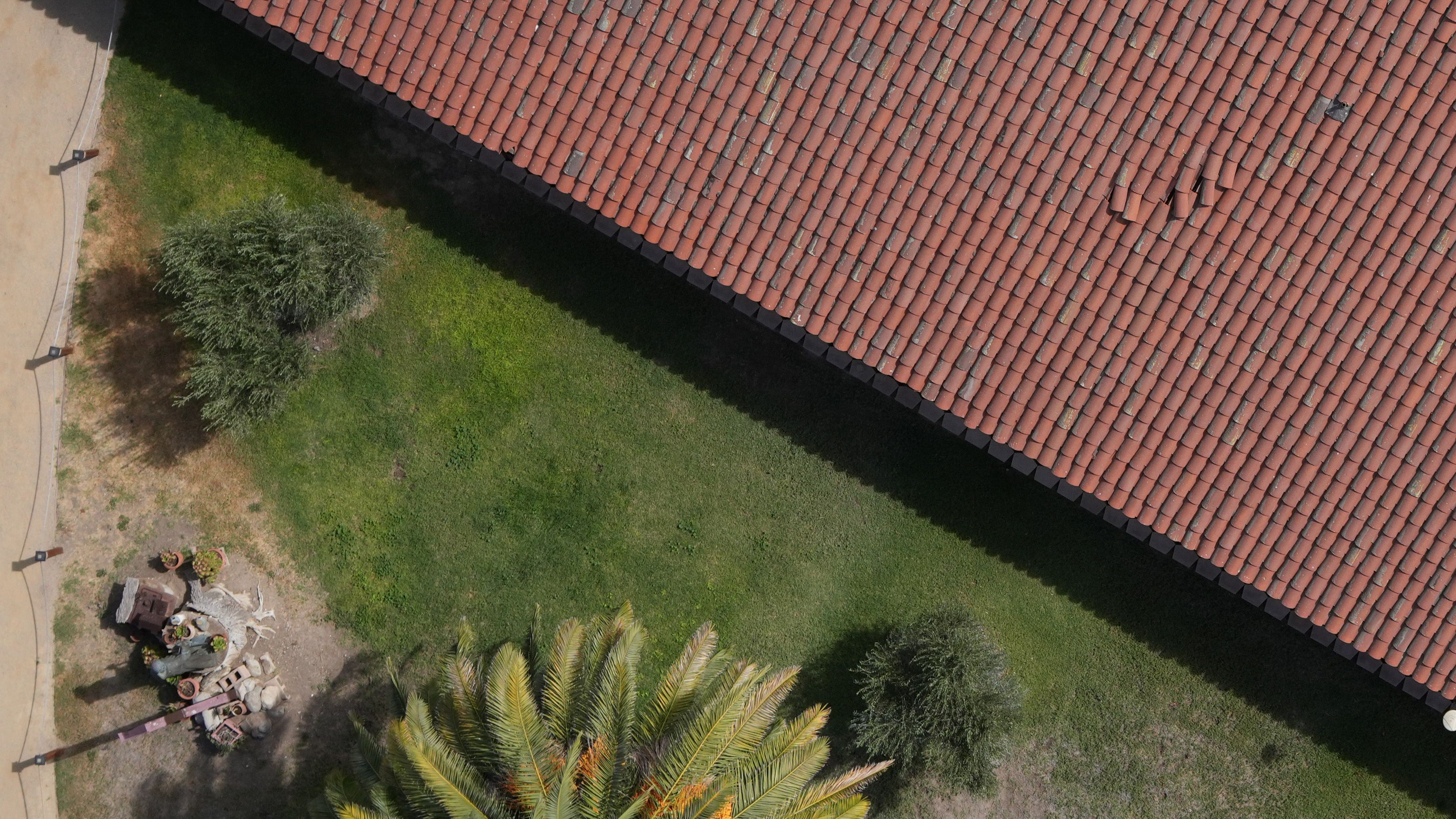
Aerial snapshot from the mission revealing weathered roof tiles in need of care
The Importance of Documenting Historic Sites with Drone Technology
Historic sites such as Mission San Miguel Arcángel are vulnerable to natural degradation, human interference, and environmental factors. Documenting these sites with aerial survey methods offers several advantages:
- Non-invasive Data Collection: Drone surveys reduce the risk of disturbing fragile sites by eliminating the need for physical interaction with the site.
- High Precision: The high-resolution imagery and precise mapping techniques provide detailed views that can assist in monitoring changes over time, helping to detect early signs of deterioration.
- Cost-effective: Compared to traditional methods, aerial surveys using drones are more affordable and can cover large areas in a short time.
- Scalability: The collected data can be scaled for use in different applications, such as 3D modeling, conservation planning, or even virtual site tours.
In the case of Mission San Miguel, the high-resolution orthomosaic map serves as a digital archive of the site’s current condition. This allows historians and conservators to track changes, make informed decisions about preservation, and prioritize areas that may require more attention.
Conclusion
The aerial survey of the San Miguel Mission using the IF800 Tomcat drone and Sony ILX-LR1 camera was a resounding success, capturing 490 high-resolution images and creating an accurate orthomosaic map of the site. The data collected will be instrumental in the ongoing efforts to preserve this significant historical landmark. The success of this mission demonstrates the value of drones in archaeology and historical documentation, allowing for efficient and precise data collection that ensures the long-term preservation of culturally important sites.
The IF800 Tomcat is a highly capable drone platform, with the endurance, stability, and payload capacity necessary for conducting thorough aerial surveys in complex environments.
Download the RAW data set from this mission here.
Related
Discover more from sUAS News
Subscribe to get the latest posts sent to your email.