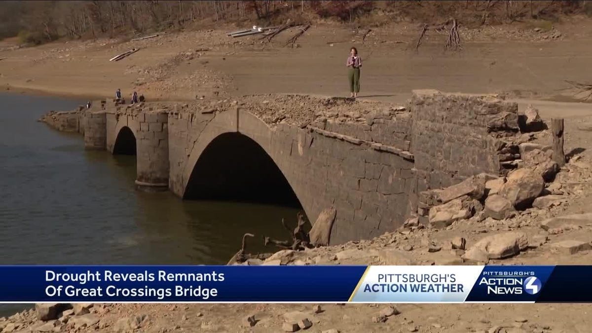
If you live in the northeastern-ish United States, you’ve probably realized it’s barely rained in a very long time. Well, you’re not imagining things because it has been so dry in western Pennsylvania that a 200-year-old bridge under the Youghiogheny River Lake has been revealed by a low water line. In the past 80 years, there have been just a handful of instances where the historic Great Crossing Bridge was visible enough to be traversed.
The sandstone bridge was built all the way back in 1818 as a means to connect Fayette and Somerset counties over the Youghiogheny River, according to ABC 4 WTAE. About 120 years later, the Yough Dam was built, leaving the bridge and several small communities inundated with water. Normally, the Great Crossing Bridge sits 50 feet underwater as people boat and fish from above, but after almost no rainfall in months, it has been uncovered. It’s the first the three arches of the bridge have been visible since 1998… which is a bit worrying.
The majority of Fayette and Somerset counties are in a severe drought, WTAE reports. Because of that, the lake’s water level has dropped considerably. In fact, it’s actually dropped about half a foot a day since late summer, Vince Klinkner, the Resources Manager at Youghiogheny River Lake, told the outlet.
“I see at least seven different articles, showing where the bridge has been out and kind of doing the same story that we’re doing here today. Ranging from the early ‘70s up until now,” Klinkner told WTAE.
I do have some good news about all of this (other than the cool bridge showing up.) The lake is still nowhere near the record for the lowest water level. In fact, Klinkner says it’s “not even close to a top three at this point,” so I suppose it could be worse. Hopefully, the bridge – cool as it may be – will be covered by water again soon. The U.S. Army Corp of Engineers expects the lake level to rebound once fall rain and winter snow kicks in.
Here’s a little bit more of the history behind the bridge, from CBS News:
“The name of the bridge is Great Crossings Bridge,” said Jacob Miller, a curator with the Historical Society of Somerset County. “Now that name comes from George Washington’s reference to the area during certain marches along Braddock’s Road and before that, that was known as the Great Crossings of the Youghiogheny River.”
Somerfield was officially settled in 1818 as ‘Smythfield,’ named after the town’s founder Philip D. Smyth. It is also the year the Great Crossings Bridge was completed as part of The National Road, which connected the Potomac and Ohio Rivers, and was the first highway built entirely with federal funds. When the bridge was completed, it was christened by President James Monroe and his entire cabinet.
[…]
In the 1930s, to help mitigate and control flooding in the region, a decision was made to build a nearby dam, raise the town, and flood the small valley.
Somerfield and the Great Crossings Bridge seemingly slipped beneath the waters into history.
Who knows if it ever actually will, though? For now, I guess we can just enjoy the fact that a whole ass bridge and remnants of a forgotten town are visible again. That’s pretty neat on its own, and we can’t really know when something like that will happen again.


